
No. 109
The Skeleton Coast: Why Namibia's Shore Has That Name
The Skeleton Coast is named for two kinds of skeletons. One kind is animal: the bones of whales and seals left along the shore from the whaling and sealing era. The other is the wrecks of ships driven aground by the coast's fog, surf, sandbanks and currents (MEFT, Skeleton Coast Park; Go2Africa). The name became famous around the world after John Henry Marsh's book *Skeleton Coast*, which told the story of the cargo liner *Dunedin Star*, stranded there in 1942 (Namibia Scientific Society).
And yes, you can go there. Skeleton Coast Park is open to visitors who book ahead and follow the rules set by Namibia's Ministry of Environment, Forestry and Tourism, known as MEFT. The photographs you have seen, with rusting hulls half sunk in sand and pale bones on a foggy beach, come from a real and very remote stretch of the Atlantic.
Where the Skeleton Coast is
The Skeleton Coast runs along Namibia's northwestern Atlantic shore, where the Namib Desert meets the sea. Most of it sits inside Skeleton Coast Park. MEFT says the park was first proclaimed in 1971 and took its present form in 1973. It stretches about 500 km from the Ugab River in the south to the Kunene River in the north, and reaches roughly 40 km inland, covering about 16,390 km² (MEFT, Skeleton Coast Park).
To the south lies the Cape Cross Seal Reserve, a separate protected area proclaimed in 1968 (MEFT, Cape Cross Seal Reserve). It holds a seal colony so large that it gets its own section further down this page.
Tap or hover a row to highlight it.
| Topic | Figure |
|---|---|
| TopicPark first proclaimed | Figure1971 |
| TopicPark in its present form | Figure1973 |
| TopicLength of the park | FigureAbout 500 km, Ugab River to Kunene River |
| TopicDistance inland | FigureAbout 40 km |
| TopicPark area | FigureAbout 16,390 km² |
| TopicCape Cross Seal Reserve proclaimed | Figure1968 |
| TopicCape fur seals at Cape Cross | FigureUp to 210,000 in the November and December breeding season |
| TopicDunedin Star stranding | FigureStruck a submerged object on 29 November 1942; beached on 30 November 1942 |
Bones and wrecks: the two skeletons in the name
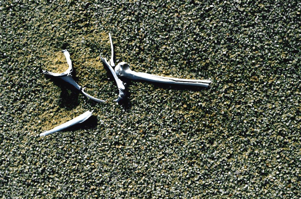
So, does the nickname refer to shipwrecks, to bones or to both? Both. Whale and seal bones from earlier whaling and sealing once lay along parts of the shore, and the wrecks of ships stranded on this coast added a second set of skeletons, the remains of hulls left on the sand (MEFT, Skeleton Coast Park; Go2Africa). None of the skeletons in the name are human; the name belongs to whales, seals and ships.
There is an older description of the place, too. The San name for this coast is commonly translated into English as "The Land God Made in Anger" (Go2Africa). You will meet that phrase in many tourism and history accounts. Treat it as a widely reported translation rather than a confirmed word-for-word rendering of a San name; if you want the original wording, a Namibian cultural or linguistic institution is the place to ask.
The book that made the name famous
The English name is older than any single book, but one book carried it around the world. John Henry Marsh's *Skeleton Coast* told the story of the *Dunedin Star*, stranded in 1942 and 1943 on the coast of what was then South West Africa, the territory that became Namibia (Namibia Scientific Society).
The book has never really gone away. In 2023 the Namibia Scientific Society announced a new edition of Marsh's *Skeleton Coast* (Namibia Scientific Society).
The Dunedin Star, 1942
The *Dunedin Star* was a refrigerated cargo liner of the Blue Star Line. She was carrying general cargo and government stores when she struck a submerged object on 29 November 1942. The next day, 30 November, she was beached on the Skeleton Coast (Blue Star Line, M.V. Dunedin Star).
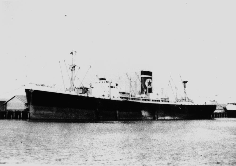
Getting the people off that beach took a major rescue. The Namibia Scientific Society describes a multinational operation that drew in South African naval, air, army, police and railway personnel, together with the Royal Navy (Namibia Scientific Society). It took that many services because of the place itself: a wreck here meant a waterless desert behind you, heavy surf in front of you and long distances in every direction.
The Skeleton Coast, from the Dunedin Star to a new edition
Tap or hover a step to follow the order.
29 November 1942
The Dunedin Star strikes a submerged object off the coast.
30 November 1942
The Dunedin Star is beached, and a multinational rescue begins.
1968
The Cape Cross Seal Reserve is proclaimed.
1971
Skeleton Coast Park is first proclaimed.
1973
The park takes its present form.
2023
The Namibia Scientific Society announces a new edition of John Henry Marsh's Skeleton Coast.
Other wrecks on the shore
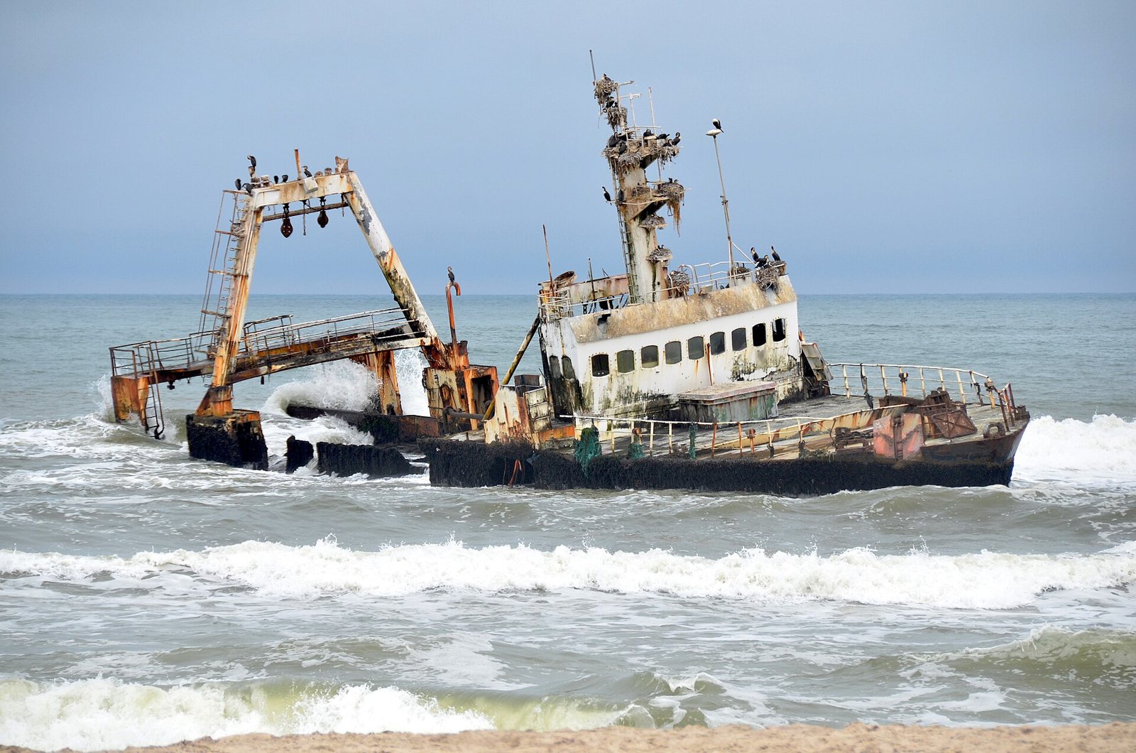
The *Dunedin Star* is the most famous wreck, but far from the only one. The *Eduard Bohlen* is usually recorded as running aground in dense fog near Conception Bay in 1909. Its wreck now sits inland from the present shoreline, because moving sand and a changing shoreline have shifted the coast away from it, leaving a ship stranded in the desert. Photographs of it sit in the Wikimedia Commons collection of Skeleton Coast shipwrecks.
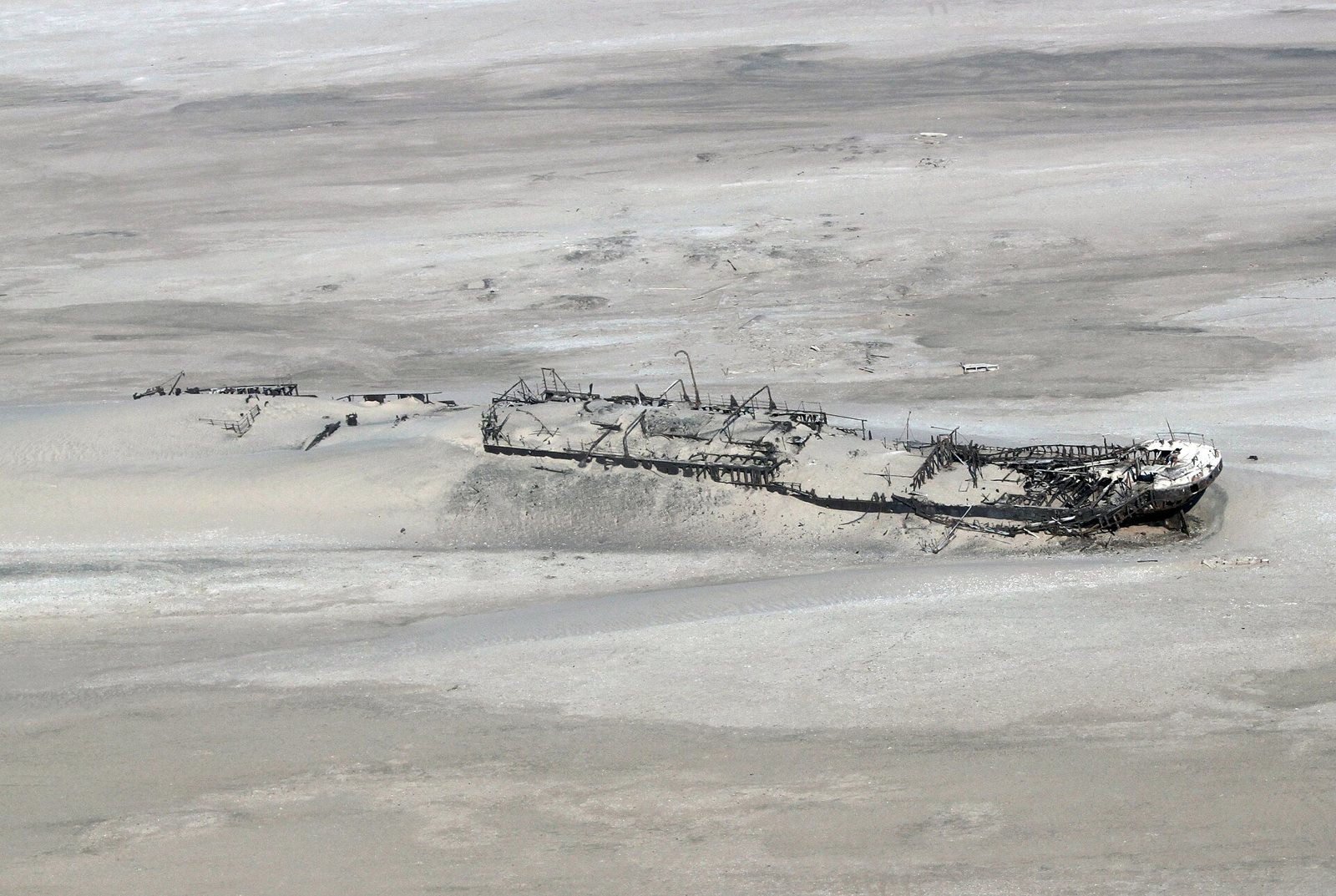
Other wrecks have become favorites of photographers. The *Southwest Seal* was photographed on 29 September 2007 (Wikimedia Commons, Southwest Seal), and the *Suiderkus*, a 1976 wreck, on 20 September 2017 (Wikimedia Commons, Suiderkus_Shipwreck_(23909699778).jpg)). The *Zeila* is another wreck in that same collection. Those openly licensed photographs are probably close to what first caught your eye.
Why so many ships came to grief here
The danger starts in the ocean. The cold Benguela Current flows north along the coast, and where cold air over the sea meets the hot, dry Namib Desert, it produces dense coastal fog (MEFT, Skeleton Coast Park). For a ship feeling its way along the coast, that fog could hide the shore until it was far too late.
Fog was only part of it. Shifting offshore sandbanks, heavy Atlantic swell and very few natural harbors made the coast a hard place to approach and a harder place to shelter. If a ship did strike, the crew and passengers faced a second danger on land: a desert with no water, strong surf between them and their vessel, and great distances from any settlement (Drink Tea & Travel). That combination is the real reason the coast earned its grim reputation among sailors.
Is the Skeleton Coast dangerous today?
For visitors today, the risks are practical rather than shipwreck-shaped. The water is cold and the surf is powerful, so swimming is unsafe. The coast is isolated, fog can cut visibility, roads are rough, and fuel and services are limited. Traveling without support, or self-driving carelessly, is where people get into trouble (Drink Tea & Travel; MEFT, Skeleton Coast Park).
If you have seen people online asking how dangerous the coastline really is, that is the plain answer: it is not a place of shipwrecks for most visitors anymore, but it is still a remote desert coast that calls for careful planning.
Lions, elephants and seals
For a place named after bones, the Skeleton Coast is busy with life. MEFT lists desert-adapted elephants, lions, cheetahs, crocodiles, springbok, Hartmann's zebra, oryx, Heaviside's dolphins and green turtles in Skeleton Coast Park (MEFT, Skeleton Coast Park).
The desert-adapted lions are the most famous of these. They have been studied by Dr Philip Stander, whose work followed lions living in northwestern Namibia, and by researchers including John Heydinger, Uakendisa Muzuma and Craig Packer (African Journal of Ecology).
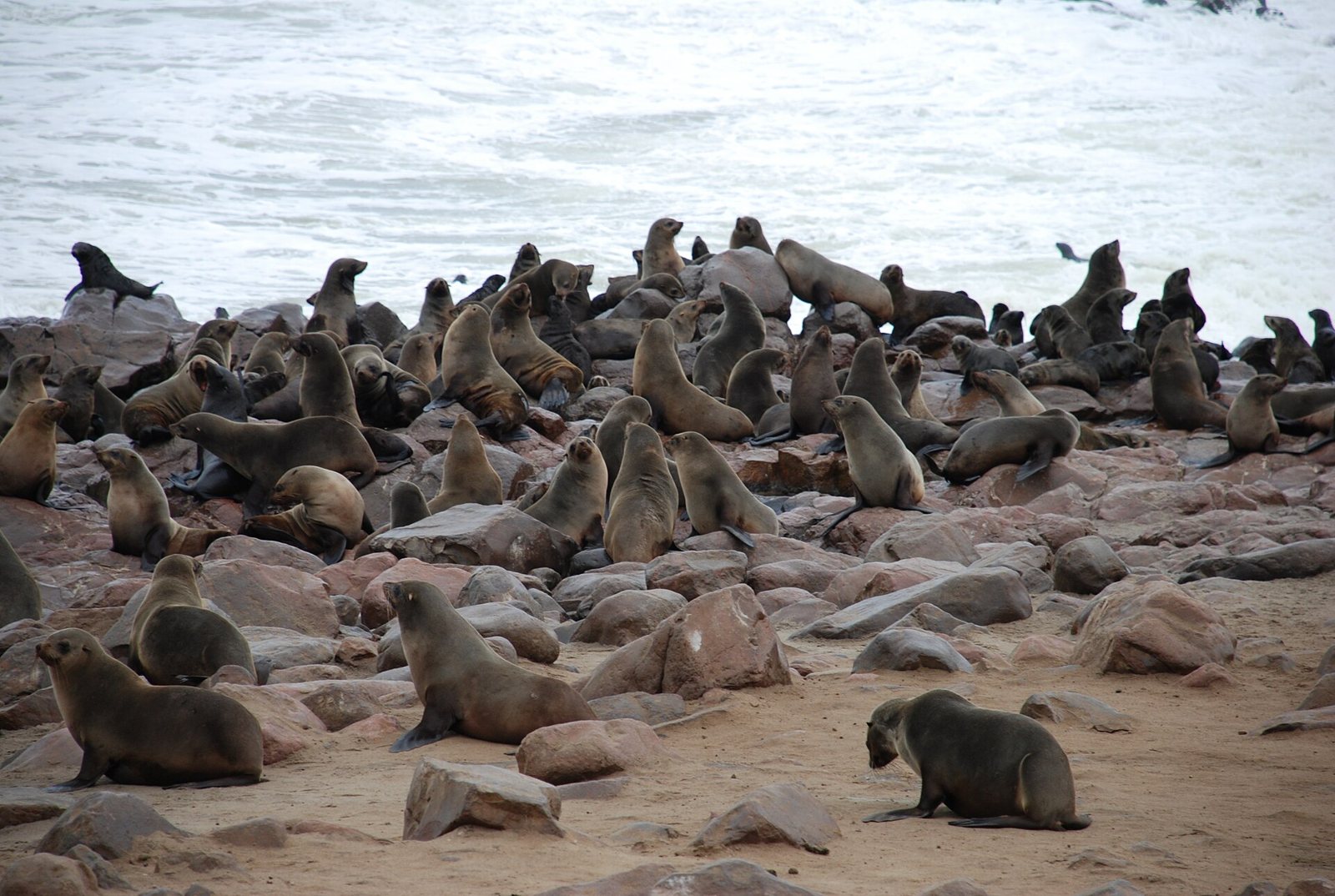
Then there are the seals. The Cape Cross Seal Reserve protects a major breeding colony of Cape fur seals, *Arctocephalus pusillus*. MEFT reports up to 210,000 seals there during the breeding season in November and December (MEFT, Cape Cross Seal Reserve). It is a fitting twist for a coast partly named after seal bones: the living animals are still here, in very large numbers.
If you are curious about the animal skeletons themselves, our stories on the elephant skull and the Cyclops and the hippo skull look at two other big African animals and what their bones have meant to people. And if you ever come across bones on a beach closer to home, found an animal skull? has general information on what to do next.
Visiting the Skeleton Coast
Namibia's official park information and the park's management plan set out the rules for visiting. Entry to Skeleton Coast Park requires a booking. A fishing license must be obtained before entering the park, and anglers need permits from the Ministry of Fisheries and Marine Resources. Vehicles must stay on the designated tracks, with 4x4s kept away from beach areas that are not designated for them, and bikes are restricted. MEFT's park information limits camping at Terrace Bay to December and January. Some southern areas allow regulated 4x4 access, while the northern concession areas may require a lodge stay or a fly-in arrangement (MEFT, Skeleton Coast Park; MEFT, Skeleton Coast Management Plan).
At Cape Cross, a public viewing walkway lets visitors watch the seal colony. The southern bird platforms are closed, and angling is prohibited in the reserve (MEFT, Cape Cross Seal Reserve).
Rules, fees and access can change, so before you travel, confirm current fees, opening hours, gate procedures and permits with MEFT, and confirm the permitted route and access conditions with MEFT or the relevant concession operator.
The park rules as MEFT lists them
Tap a card to bring it forward.
- Booking: Entry to Skeleton Coast Park requires a booking.
- Fishing license: Obtain a fishing license before entering the park; anglers need permits from the Ministry of Fisheries and Marine Resources.
- Tracks: Vehicles stay on designated tracks, and 4x4s keep away from beach areas not designated for them.
- Bikes: Bikes are restricted in the park.
- Terrace Bay camping: Limited to December and January in MEFT's park information.
- Northern concessions: May require a lodge stay or a fly-in arrangement.
- Cape Cross: Use the public viewing walkway; the southern bird platforms are closed and angling is prohibited.
- Before you go: Confirm current fees, hours, permits and routes with MEFT or the concession operator.
Questions people ask about the Skeleton Coast
Why is it called the Skeleton Coast?
It is called the Skeleton Coast because whale and seal bones once lay along parts of the shore and because shipwrecks added the skeletal remains of vessels. The name spread widely after John Henry Marsh's book about the 1942 *Dunedin Star* rescue (Namibia Scientific Society).
Is the Skeleton Coast dangerous?
It was dangerous for ships because of the Benguela Current, dense fog, shifting sandbanks and heavy surf. For visitors today the risks are cold water, isolation, rough roads, limited fuel and ignoring the park rules (MEFT).
Can you visit the Skeleton Coast?
Yes, Skeleton Coast Park can be visited with a booking, and some southern areas allow regulated 4x4 access. Fishing needs a license or permit, vehicles must follow designated tracks, and the northern concessions may need a lodge or fly-in arrangement (MEFT, Skeleton Coast Management Plan).
Why is the Costa de los Esqueletos dangerous?
The coast is dangerous for ships because of dense fog, the cold Benguela Current, shifting sandbanks and strong waves. For visitors, isolation, cold water, difficult roads and few services call for careful planning (Drink Tea & Travel).
Where can you see desert lions and seals?
Desert-adapted lions live in Skeleton Coast Park and the wider northwest of Namibia, and Cape fur seals gather in huge numbers at the Cape Cross Seal Reserve. MEFT reports up to 210,000 seals at Cape Cross in November and December (MEFT, Cape Cross Seal Reserve).
How well do you know the Skeleton Coast?
Answer every question to check.
A coast of bones that is full of life
The name sounds like a warning, and for sailors it was one. Whale and seal bones, the ribs of wrecked ships and a fog that rolls in off the cold Benguela gave the Skeleton Coast its reputation, and the *Dunedin Star* gave it a story the whole world could read. Today the same shore is a protected park where desert-adapted lions live and up to 210,000 Cape fur seals gather at Cape Cross to breed. Skulls and skeletons tend to mean something different depending on where you find them, as our page on skull symbolism shows; on this coast, they mean the sea always wins in the end, and life comes back anyway.
Terms in this story
Tap a term to see what it means.
Skeleton Coast Park. The protected area on Namibia's northwestern Atlantic shore, first proclaimed in 1971 and in its present form since 1973, running about 500 km from the Ugab River to the Kunene River.
---